-
AISWare AIMAP helps an operator group headquarters build a network-wide intensive GIS platform
-
Customer requirement
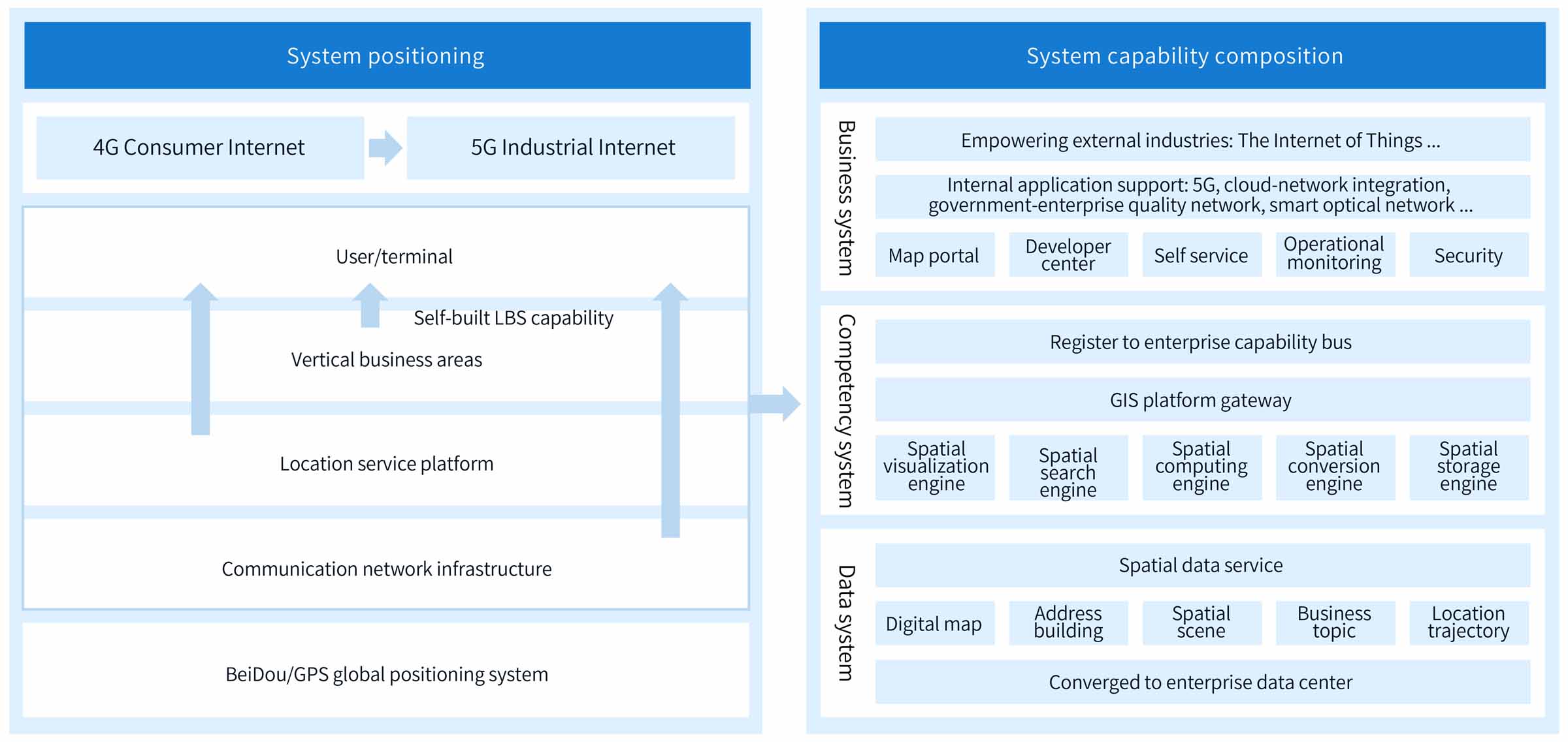
In order to achieve the goal of intelligent operation of the entire network, an operator creates an intensive GIS capability platform with its own characteristics, supporting the map application construction requirements of entire network 5G construction, cloud-network integration, government and enterprise quality network, smart optical network, Internet of Things, LBS platform and other business systems in the group and provinces. The operator self-builds the GIS core capabilities and breaks through the tradition single construction model of integrating third-party GIS software. It adopts the data middleground platform architecture, distributed and containerized deployment to breaks through the performance bottlenecks of massive spatial data aggregation, map visualization, spatial search, spatial analysis, and spatial storage. It registers GIS capabilities to the enterprise capability bus, provides ready-to-use data services and lightweight OpenAPI, and realizes spatial data sharing and secondary development service support for the entire network.
亚信科技
-
Products&Technologies
-
Technology and Product Portfolio
-
Cloud & Network
-
Data Intelligence
-
- AISWare Usights • LLMs for Verticals
- AISWare Usights • TAC MaaS
- AISWare Usights • AI Agent Platform
- AISWare Usights • ChatBot
- AISWare Usights • ChatBI
- AISWare Usights • AIOps Agents
- AISWare Usights • AutoAgent
- AlSWare Usights · TuringDevSuite
- AISWare AI² Edge Intelligence
- AISWare Ontology Platform
- AISWare DataAtlas
- AISWare DataFlux
- AISWare IO—Intelligent Operation
-
-
IT
-
Technical Support
-
Technology and Product Portfolio
- Solutions & Services